Integrated Monitoring in Bird Conservation Regions (IMBCR)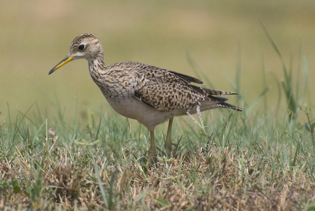
Monitoring is an essential component of wildlife management and conservation science. Effective monitoring programs can identify species that are at-risk due to small or declining populations, provide an understanding of how management actions affect populations, evaluate population responses to landscape alteration and climate change; and provide basic information on species distributions. Given the large-scale declines of avian populations and the loss, fragmentation and degradation of native habitats, the need for extensive and rigorous landbird monitoring programs is greater than ever.
In 2007 the North American Bird Conservation Initiative developed a report ‘Opportunities for Improving Avian Monitoring’ (NABCI 2007). This report outlined goals and recommendations to further improve avian monitoring programs including: using more rigorous statistical methodology, integrating monitoring programs, and making data and results widely accessible to land managers and the public. With these recommendations in mind, bird conservation partners from across much of the western United States have collaborated to implement a new broad-scale all-lands monitoring program known as “Integrated Monitoring in Bird Conservation Regions” (IMBCR) (Skorkowsky et al., in prep.). The IMBCR design has since updated many long-term monitoring programs such as Monitoring Colorado Birds, Monitoring Wyoming Birds and the Northern Rockies Landbird Monitoring Program.
Objectives of the IMBCR program are to: 1) provide a framework to integrate bird monitoring efforts across bird conservation regions; 2) provide robust population density and occupancy estimates that account for incomplete detection and are comparable at different geographic extents 3) use annual population estimates to monitor population trend and evaluate causes of population change; 4) provide basic habitat association data for most landbird species to address habitat management issues; 5) maintain a high-quality database that is accessible to all of our collaborators as well as to the public over the internet, in the form of raw and summarized data; and 6) generate decision support tools that help guide conservation efforts and provide a quantitative measure of conservation success.
Using the intersection of BCRs and state boundaries as the primary level of stratification, substrata are defined by IMBCR partners based on areas to which inferences are needed, for example, an individual National Forest. Spatially balanced samples are selected within each substratum using a generalized random tessellation stratification algorithm (Stevens and Olsen 2004). This sampling design allows direct comparison of density and occupancy estimates among geographic areas and across spatial scales. Birds are surveyed from a grid of points within each sample unit during a six minute period. Observers record distances to each bird and the 1 minute interval during which each bird was detected. These data are used to estimate occupancy rates at two spatial scales (Pavlacky et al. 2011) and density using distance sampling theory (Buckland et al. 2001).
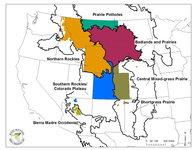
Areas that are surveyed using the IMBCR program. Colored regions indicate areas surveyed under the IMBCR design. Black lines indicate Bird Conservation Region boundaries within the Rocky Mountain Region.
The strength of the IMBCR monitoring program is based in its broad partnership support. Partners to this program currently include the U.S. Forest Service (Regions 1, 2 and portions of 3 & 4); U.S. Bureau of Land Management (SD, ND, CO, WY and MT); Colorado Division of Parks and Wildlife; Wyoming Game and Fish Department; Montana Fish, Wildlife and Parks; USFWS Great Plains and Great Northern Landscape Conservation Cooperatives; Northern Great Plains Joint Venture; Intermountain West Joint Venture; Rocky Mountain Bird Observatory; Avian Science Center; Idaho Bird Observatory; Wyoming Natural Diversity Database; Montana Natural Heritage Program; and Audubon Wyoming.
Information gathered under the IMBCR design is disseminated through annual reports (http://www.rmbo.org/v3/InfoCenter/Publications/Reports/Science.aspx), region-specific bird monitoring publications, species accounts and bird conservation information and scientific publications. Additionally, information on bird/habitat associations, species distributions and raw count data are made accessible to the general public through the Avian Data Center at http://www.rmbo.org/public/monitoring/. Please visit the RMBO website (http://www.rmbo.org) or partner (http://www.montanabirds.org/) websites if you would like additional information regarding IMBCR monitoring efforts.
References
Buckland, S. T., D. R. Anderson, K. P. Burnham, J. L. Laake, D. L. Borchers, and L. Thomas. 2001. Introduction to Distance Sampling. Oxford University Press, London, UK.
Pavlacky, D. C., Jr., J. A. Blakesley, G. C. White, D. J. Hanni, and P. M. Lukacs. 2011. Hierarchical multi-scale occupancy estimation for monitoring wildlife populations. Journal of Wildlife Management. In press.
Skorkowsky, R. C.; J. A. Blakesley, P. M. Lukacs, D. Klute, and D. J. Hanni. 2011. Integrated Monitoring in Bird Conservation Regions. Draft manuscript in preparation.
Stevens, D. L., and A. R. Olsen. 2004. Spatially balanced sampling of natural resources. Journal of the American Statistical Association 99:262-278.
U. S. North American Bird Conservation Initiative Monitoring Subcommittee. 2007. Opportunities for Improving Avian Monitoring. U.S. North American Bird Conservation Initiative Report. 50 pp. Available from the Division of Migratory Bird Management, U.S. Fish and Wildlife Service, Arlington, VA; on-line at http://www.nabci-us.org/.